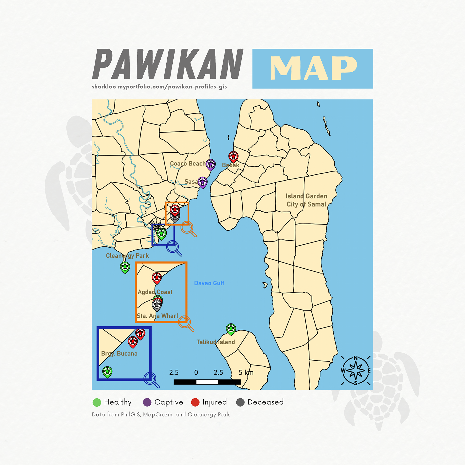
Project Overview:
As part of my course requirements for "Introducing Mapping, Spatial Data, and GIS 2" under the Department for Continuing Education at Oxford University, I undertook a project focused on creating a Geographic Information System (GIS) map for sea turtle sightings in Davao City, Philippines. The primary objective of this project was to gain a comprehensive understanding of these sightings, identify the main threats to sea turtle populations (locally known as "pawikan"), and develop strategies for their conservation and protection.
Map Creation:
Project Background
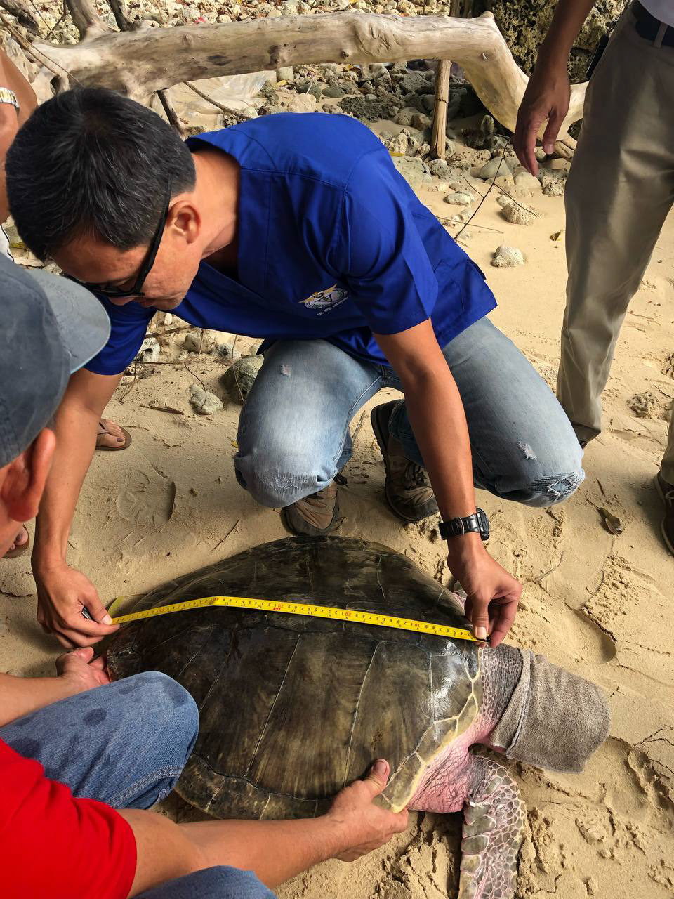
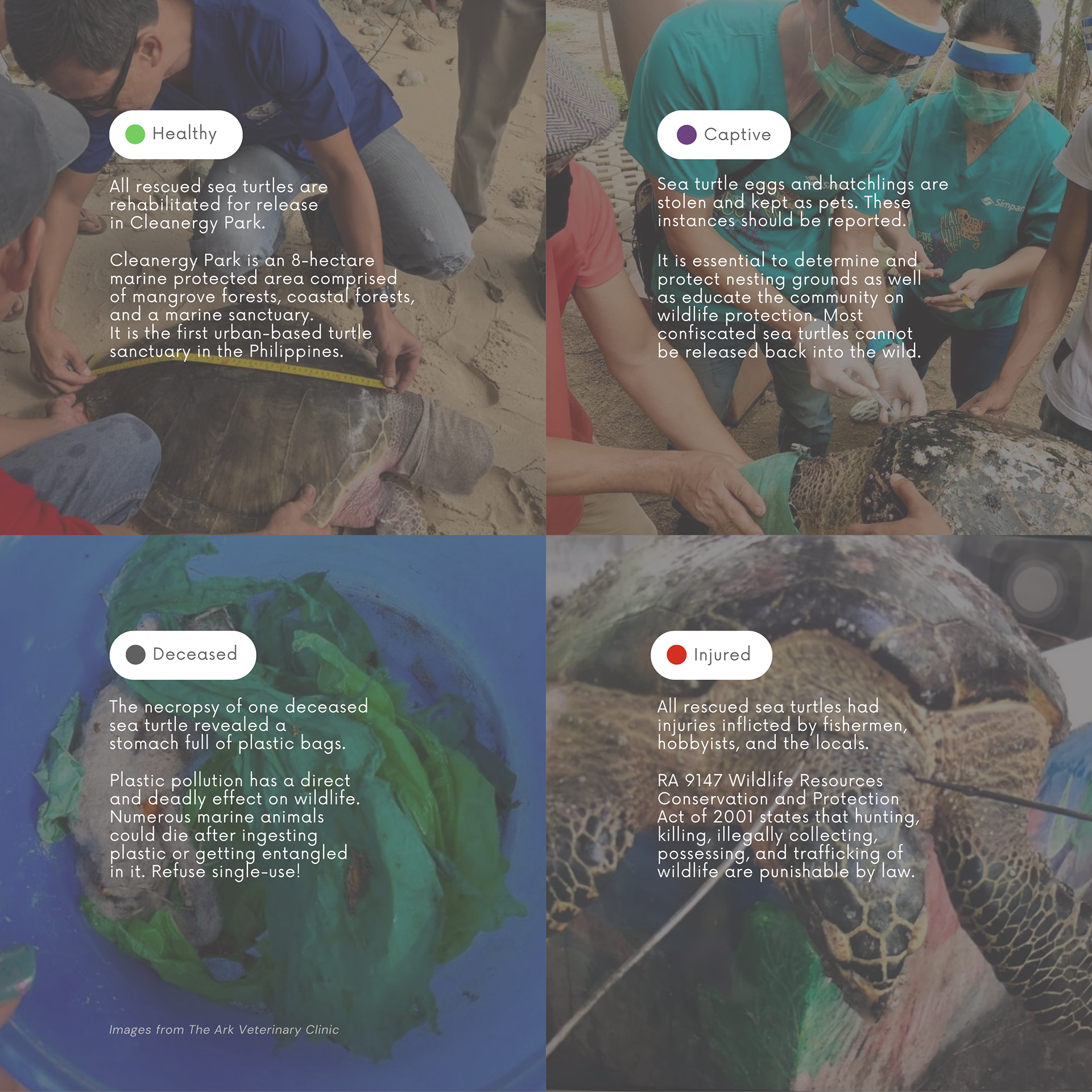
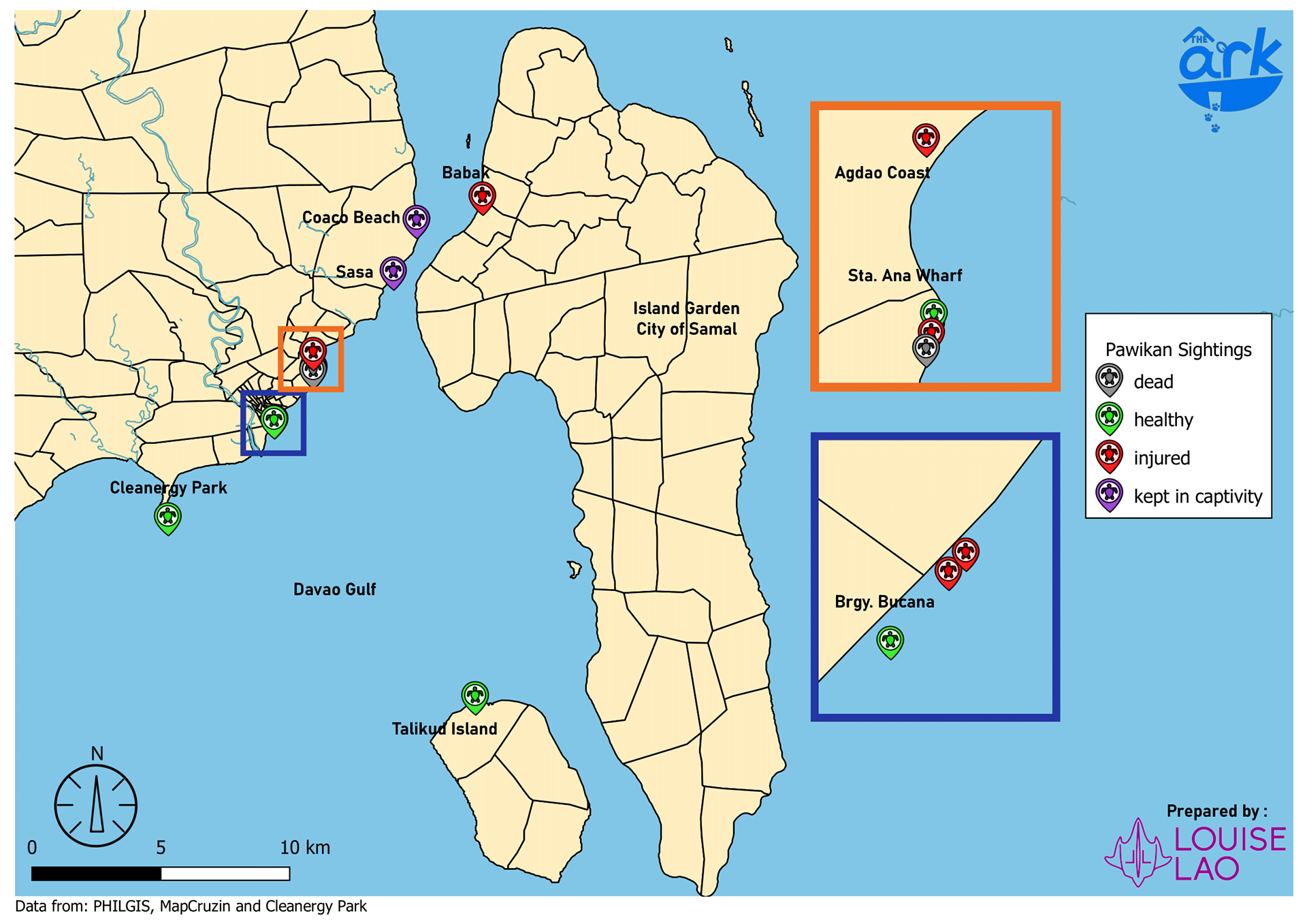
To keep a healthy ocean, it is important to maintain balance in the ecosystem. Marine conservation involves protecting marine ecosystems and species not only by preserving populations and habitats but also by mitigating destruction by human activities and offering lifestyles that minimize the direct and/or indirect effects on marine life. For this project, sea turtles are the specific target population within the marine ecosystem. Sea turtles specifically use the Earth’s magnetic field to find their way back to where they were hatched, which is why Cleanergy Park, owned by the Aboitiz Foundation in Davao City, is the first urban-based turtle sanctuary in the Philippines dedicated to protecting their nesting grounds and rehabilitating surrendered or confiscated sea turtles hopefully for future release.
GIS Layers
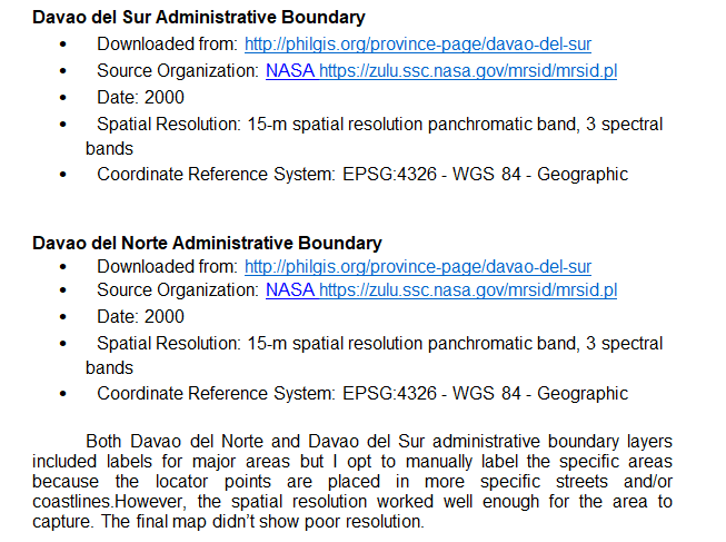
The decision of which Coordinate Reference System to use greatly depended on the availability of data. The map I have created uses the EPSG:4326-WGS 84-Geographic Coordinate System in line with the data layers I downloaded to represent Davao City, the fundamental elements of the map in order to properly represent the pawikan sightings, keeping in mind that Coordinate Reference Systems exist to relate two-dimensional projected maps to the multi-dimensional real world.
Final Map
Way Forward:
The ultimate goal of this project was to contribute to the preservation of sea turtles in Davao City by providing evidence-based recommendations for mitigating the identified threats. By better understanding the distribution, trends, and challenges faced by pawikan populations through the GIS map, I aimed to raise awareness, engage stakeholders, and foster collaborative efforts to protect these magnificent creatures and their habitats.
This project underscores the significance of GIS and spatial analysis in informing conservation initiatives and highlights the importance of community engagement and proactive measures in safeguarding endangered species like sea turtles.
Louise Lao | 2020 | Oxford University- Department for Continuing Education